Travel Guide to Mpumalanga Province
Mpumalanga Province
East of Gauteng lies Mpumalanga, 80.000 sq kms of well watered highveld, the dramatic Eastern Escarpment (Panorama Route), and the hot, dusty, flat Lowveld – largely occupied by the huge Kruger National Park. It is bounded on the north across the Oliphant’s River by Limpopo province, on its east by Mozambique (which borders the Kruger National Park) & to the south by Kwa-Zulu Natal. It has become one of the country’s main tourist destinations, easily accessible by road (it is strongly recommended to have or hire a car to visit the region). From Gauteng the 450 kms odd to the Kruger National Park (KNP) is an easy drive by motorway M-4 / N-4, giving plenty of time to arrive by mid-afternoon. The region is also well served by air – to Phalaborwa (for the northern section of the NP), Hoedspruit (central section) or Nelspruit (the provincial capital; south of the NP) Cars can be rent at all these airports. Many private game-reserves surrounding the KNP have their own landing strips for small chartered aircraft. See Map at: http://www.suedafrika.net/Norden/mplp_map.htm
Driving east from Pretoria, the M-4 / N-4 , crosses the rich Highveld – a major maize and cash crops producing area. The region is also a large coal mining area and the landscape is dotted with huge thermal power-stations built right alongside the colleries.
— Witbank a major centre for coal mining and its export (via Richards Bay KZN) has developed into a large, bustling industrial and farming town. Winston Churchill hid in a colliery near Witbank during the Second Boer War after his escape from Pretoria….
— Middelburg is the modern agricultural & industrial centre for the surrounding western area of the province. It is known as the Stainless Steel Capital of Africa, being home to a large stainless steel plant (Columbus Stainless) It is also a major centre for the Ndebele people. If you have not visited any of the colourful Ndebele villages and their people in the Pretoria area, a stop here is well warranted – at the Botshabelo Historical Village and craft market, and Traditional Ndebele Village north of the town. See: http://www.southafrica.net/za/en/articles/entry/article-southafrica.net-botshabelo-mission-station#.UojaTZSEiUk
— For the most interesting route to the KNP, turn off the N-4 at Belfast, taking the R-540 through Dullstroom to Lydenburg , Ohrigstad and the R-36 down into the Lowveld. The drive between Belfast and Dullstroom at around 2.100 metres is the highest altitude Highveld in the country.
—Dullstroom – a pretty village, is South Africa’s premier trout and fly-fishing centre, a perfect stop off point for a good trout lunch. The town has the highest railway station in South Africa at 2,077 m, as well as the highest point in the province at 2,332 m. Dullstroom in winter is one of the coldest towns in the country – and the only place where beech and elm trees grow in S. Africa !
Continue on the R-540 and then the R-36 road down to the Lowveld, through the Abel Erasmus Pass and tunnel, ignoring all the turnoffs and other distractions… Pilgrims Rest, Blyde River Canyon etc (you will visit them soon enough – but in the interim, the goal is the Lowveld.. and the Kruger National Park)… or the private game reserves around it. From Hoedspruit continue south along the R-40 to whichever KNP entry gate, or private reserve you have chosen . (see below)

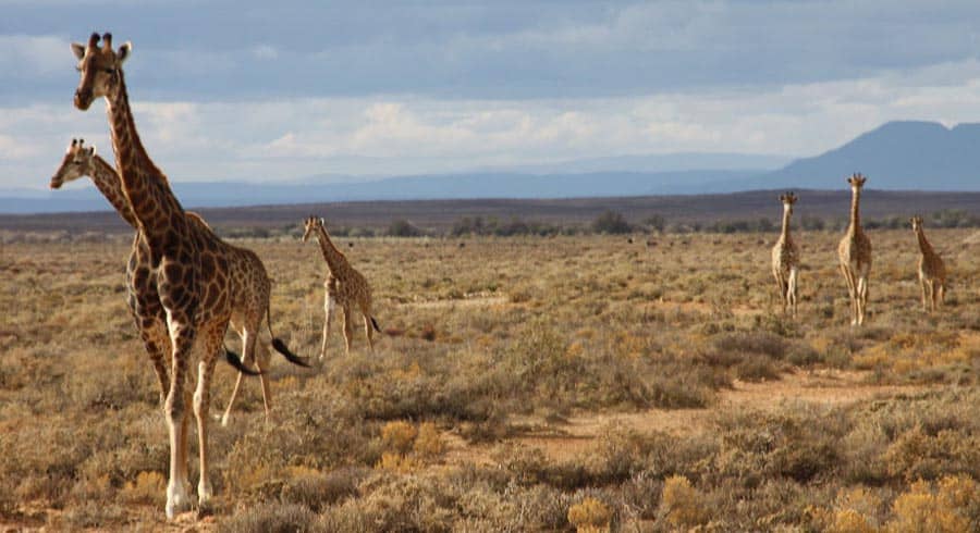
The Kruger National Park is one of the largest game reserves in Africa – if not the world. It covers an area of 20.000 sq kms (larger than Gauteng – and 2/3rds the size of Belgium). About half the NP lies in the northern province of Limpopo, the southern half in Mpumalanga. It is 360 kms in length, 65 kilometres in width. The HQ are at its main centre and camp, Skukuza. The NP was first protected by the Boer Government in 1898, becoming South Africa’s first NP in 1926. It’s now part of the Great Limpopo Transfrontier Park that links Kruger National Park, the Gonarezhou National Park (Zimbabwe), and the Limpopo National Park in Mozambique. The park is part of the Kruger to Canyons Biosphere, designated by UNESCO as an International Man and Biosphere Reserve. General overview, rest camps etc at: http://www.youtube.com/watch?v=_K5adinpgAg
The entire park is located in the Lowveld – low altitude, flattish land characterized by sandy open bush and grassland as well as acacia, thorn trees, Mopani, sycamore fig and marula trees and other open and dense forest and bush. The southern area of the park, between the Oliphant’s and Krokodil Rivers has the highest rainfall, which decreases moving north.
The climate is generally very humid and hot in summer – often in excess of 35 C, but it’s milder during the dry winter period, when overnights frosts can occur, although the days are still warm, usually into the mid-20s … The dry winter (May – October) season is peak game spotting period, the bush being thinner and waterpoints less numerous and further apart (having said that though, a visit any time of year is usually more than well rewarded by the animal life you’ll see!). The climate is almost the opposite to that of the Highveld, from which you would have just driven down – and which at over 1.000 metres above the Lowveld is easily seen from the NP.
NB: – Parts of the Lowveld, including the KNP are classed as a Malaria zone. But it is also an overwhelmingly dry area and NOT a mosquito-infested swamp and the malaria risk in the park is low. Personally I have never taken any anti-malaria drugs or treatments for/on my visits there. That has been entirely my decision. It is recommended that you follow your own doctors’ & medical services advise as to what treatment and/or drug is applicable for the area. Most anti-malaria treatments have to be started before arriving in the Lowveld – or even the country! http://www.sanparks.org/tourism/malaria/
The park has 9 main gates that allow entrance to different areas and camps in the park. See details of camps, their location, accommodations, facilities, tariffs etc at :-http://www.krugerpark.co.za/Kruger_National_Park_Lodging_&_Camping_Guide-Travel/Kruger_National_Park_Lodging_&_Camping_Guide.html and at :- http://www.sanparks.org/parks/kruger/camps/ The rest camps have a wide range of accommodations – camping to luxury lodge, bush camps, even overnight hides. Most camps have supply shops, restaurants and some petrol facilities; all are beautifully appointed and operated. The park can be visited alone by car, with guides, by bush walks and on 4×4 trails. There are even 3 day guided game viewing hikes using your camp as the base. See camps, self-drive options, hikes and trails here: http://www.krugerpark.co.za/Maps_of_Kruger_Park-travel/kruger-park-walking-trails-map.html
Reservations are essential, and its highly recommended to do research ahead of time as to the choice of area, camps, type of accommodation and locations you prefer. Maps, game sightings are provided by the camp each morning. You are totally free to explore and discover the network of roads, viewing platforms and ‘vleis’ or ‘pans’ (waterholes) at your leisure. There is far too much detail to go into here but invest a good bit of time and effort in discovering and familiarizing yourself with what the KNP and its region offers to suit your specific and preferred interests.
The northern portion of the KNP has its own attractions, landscapes, is a lot drier, and can be very different to the southern reaches of the park. It however involves a lot more road time and driving getting there. The ‘return’ trip southwards can be done through the park itself. For more info see: http://www.southafrica.net/sat/content/en/au/what-to-do/the-great-outdoors/wildlife-and-safari/the-northern-kruger-national-park-0/
The KNP is bordered by literally dozens of private game reserves, many of which have opened their fences with the KNP, thus enlarging the NP and increasing the animals access to the area as well. These private reserves offer visitors an African experience without compare – in total luxury. They are ideally setup (scouts, inter-team information, animal locations etc) to see the maximum amount of game in the most limited period of time – something tourists who visit the KNP themselves will not necessarily have.
Whichever way you choose to visit and see the KNP, it is bound to be one of the highlights of your South African trip. It is one of the largest, wildest, untamed areas in the world, a place where raw nature governs the show, where Africa is at its prehistoric best – and where we can never be anything more than rather insignificant spectators to Nature’s laws, wonder and glory. Enjoy ! For the private reserves, see my Introduction- Accommodations text reproduced below 🙂
** Private game reserves surround most of the National Game Parks, like Kruger, effectively extending the area of the National Park itself. All of them have a few to several lodges and are a perfect way to see the maximum amount and variety of game in a limited period of time as well as live the ‘real’ African bush life in total comfort and luxury. Accommodations are often in elevated safari tents with all modern conveniences, scattered around a central ‘boma’, bar and social area. A stay includes safaris, breakfast, sunset “sundowner” drinks and snacks at a waterhole and top-notch gourmet meals centered on South African cuisine and game dishes. But they’re not cheap – generally in the region of about R 5.000 (approx $ 500) per person per day. Many private reserves also offer a selection of various ‘fun’ add-ons; dawn hot-balloon rides, bush treks by foot, on horse (and even on elephants!) Usually a stay of 2 full days will suffice for all but the most ardent wild game fans.
For the Kruger area check out http://www.kapama.co.za/ , one of the friendliest and easy going of the lodges. They also include visits to their cheetah and wild dog breeding programs. Other private reserves in the central and southern reaches of the KNP include:- Timbavati http://www.timbavati.co.za/ Thornybush http://www.thornybush.co.za/ Sabi Sabi http://www.sabisabi.com/ Sabi Sand http://www.sabisand.co.za/ Mala Mala http://www.malamala.com/
Above: panorama route
The PANORAMA ROUTE (Eastern Escarpment)
Upon leaving the KNP (or private reserve) take the same route back towards Hoedspruit (Hoo-d-spraytt) and back up the escarpment and Abel Erasmus Pass to the turnoff for Blyde River Canyon. Alternatively, if you have stayed further south in the KRP drive toward Hazyview on the R-40, and then up the escarpment to Graskop. From Graskop take the drive directly through to Blyde River Canyon. This trip, from the KNP, up, along and through the Panorama Route ends up in Pilgrims’ Rest for the night, & can easily be done in 1 day. But its recommended to spend the first night at Blyde River Canyon, the next night in Pilgrims’ Rest.
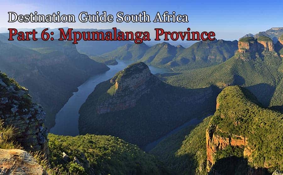
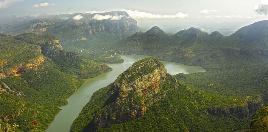
Blyde River Canyon is one of the 5 largest canyons – and the largest “green’ canyon – in the world. It is 28 kms long, averages 800 metres deep and its greatest denivelation is over 1.300 metres. It is famous for the “Three Rondavels”, huge rock outcrops that look like African huts. The canyon is in a 29.000 hectare nature reserve that offers wonderful panoramas and vistas over the canyon, the gorge and parts of the lowveld 1.000 metres below . A wide range of accommodations are available at the canyon See :- http://www.foreverblydecanyon.co.za/ Also:- http://www.southafrica.net/sat/content/en/au/what-to-do/the-great-outdoors/wildlife-and-safari/the-blyde-river-canyon-nature-reserve-0/
On the R-532 back towards Graskop are Bourke’s Potholes – a strange natural result of swirling water erosion and eddies at the confluence of the Treur and Blyde Rivers. The site is interspersed with waterfalls, rivers and rapids, connected by a series of metal bridges above them – and the ‘potholes’ Visitor interpretation centre. A great place to walk around or have a picnic ! http://www.sa-venues.com/attractionsmpl/bourkes-luck-potholes.htm
Nearby, a few kms south, is a circular turnoff (R-534) to God’s Window, right on the edge of the escarpment, with a fantastic view the 1,000 meters down over forested land onto the Lowveld ! This is the Eastern Escarpment, the southern end of the huge African Rift Valley that stretches north through East Africa to Somalia, the Red Sea and the Dead Sea. A little further along the same road is The Pinnacle (God’s Finger) a huge rock outcrop overlooking the Lowveld too. To the right and below the viewing area you can see the topmost of eight waterfalls that drop more than 450m into the valley below . http://www.sa-venues.com/attractionsmpl/gods-window.htm
The entire area is ‘Waterfall Territory” . Just across the road from God’s Window and the Pinnacle, off the R-532, are the 92 metre Lisbon Falls and 45 metre Berlin Falls while just south of Graskop on the Sabie road (still the R-532) are Marie Shires Falls, the Forest Falls and the Mac-Mac Falls & Pools. At Sabie, are the Sabie Falls and off the main route, Bridal Veil Falls, Horse-shoe Falls and Lone Creek Falls. See map at: http://www.graskop.co.za/trips/regional_map.htm More details/info on the area at: http://www.graskop.co.za/seedo/
From the town of Sabie continue on the R-37 up the Long Tom Pass to Lyndenburg. From Lyndenburg follow the R-36 north, turning off to the right on the R-533 to Pilgrims’ Rest – (suggested overnight stop). Pilgrims Rest, an old alluvial and gold mining village dating back to the late 19th Century is a national monument, totally preserved with its original “wood and iron” houses, bars, hotels etc . It makes a wonderful and fascinating historic base from which to explore and discover the entire Panorama Route. Visits of the old mining facilities as well as gold panning are amongst the rather unique attractions of the town. More at: http://www.southafrica.net/za/en/articles/entry/article-southafrica.net-pilgrims-rest#.UokeIpSEiUk http://www.pilgrims-rest.co.za/
From Pilgrims’ Rest, drive to Graskop and then to Sabie from where you follow the R-537 to White River and onto Nelspruit – whether you are returning to Gauteng or continuing down to KZN directly, or through Swaziland.
Nelspruit (Nel-spraytt) is the capital city of Mpumalanga and considered to be South Africa’s largest “Tropical City”. It’s a very attractive, dynamic centre with flamboyants, flame and other flowering trees lining its streets. Set amongst lush forest covered hills, it is a major centre for citrus and tropical fruits (mangos, bananas, avocados, guava, macadamia nuts). (Visit the huge Halls fruit farm just outside town). Only 330 kms from Johannesburg it is on the main road (N-4) and rail line between Gauteng and Maputo (Mozambique) and a major export point .
It has the world-class Lowveld National Botanical Gardens, specialized in Lowveld tropical and sub-tropical plants and trees, and is the site of the world’s first ‘man-made’ rain forest – a simulated, tropical African rainforest, representing the rapidly disappearing tropical rain forests of Central and West Africa. The Gardens are crossed by 2 rivers and have the largest waterfalls in the region. http://www.sanbi.org/gardens/lowveld/wildlife-biodiversity
35 kms from town just off the N-4 road to Johannesburg are the famous Sudwala Caves and Dinosaur Park. http://sudwalacaves.com/sudwala-caves-nelspruit-mpumalanga.html For other activities around the area see also: http://sudwalacaves.com/things-to-do-sudwala-caves.html http://www.places.co.za/html/nelspruit.html
From Nelspruit visitors returning to the Gauteng region take the N-4 once again. If heading to Kwa-Zulu Natal, take either the route (R-40) through Barberton and across Swaziland to northern KZN; or the road R-38 from just before Barberton, to Carolina and into KZN at Ermelo onto Volksrus and Ladysmith) near the northern end of the Drakensberg Mts (and Amphitheatre) See section on Kwa-Zulu Natal – Drakensberg Mts.
TOP TOURS TO EXPERIENCE IN MPUMALANGA PROVINCE


Leave a Reply