
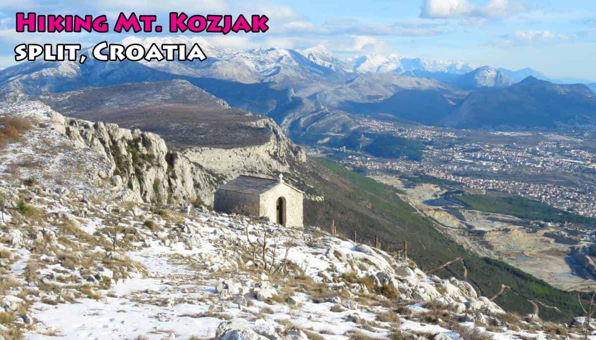
 Hiking Mt. Kozjak
Mt. Kozjak is maybe my favorite hike in the Split area. I did it with my Croatian friends Goran and Vedran. Our first attempt was in 2019 and we made it halfway before having to abort. In 2020 we continued from where we had left off and completed the hike.
This post sums it all up and I’m hoping that it’s a useful guide for anyone thinking of hiking Mt. Kozjak.
————————-
Mount Kozjak is often overlooked by visitors looking to do some hiking in the Split area. That’s a shame because Kozjak makes for a great hike. Why? Because it’s easy, has great views, is easily accessible from Split…and it can be combined with a visit to Klis Fortress.
For those unfamiliar with Kozjak: it is the long mountain that looms over the coast stretching from Trogir to Split. It looks like a wall of rock and in some areas it really is a sheer, inaccessible wall of rock. But despite it looking very intimidating it’s actually quite easy to climb…and once up top it is (mostly) flat trekking from any point along the length of the 20km mountain.
Why hike Kozjak?
1) It is accessible from Split (more so than Mount Mosor). Your Kozjak hike can be started from a few different access points.
2) The views are incredible from every point in the hike. You are basically walking along a ridge the whole way, the Adriatic on one side, the Dalmatian interior on the other.
3) Difficulty wise, hiking Kozjak is easy. There’s not much of a variation in altitude along the ridge. I think it’s more of a “walk” than a “hike”. I wouldn’t recommend Mosor in the summer…but Kozjak, if done right (and bringing lots of water and sunscreen) is doable.
4) If planned right, you can finish the hike in Klis and visit Klis Fortress all in one day.
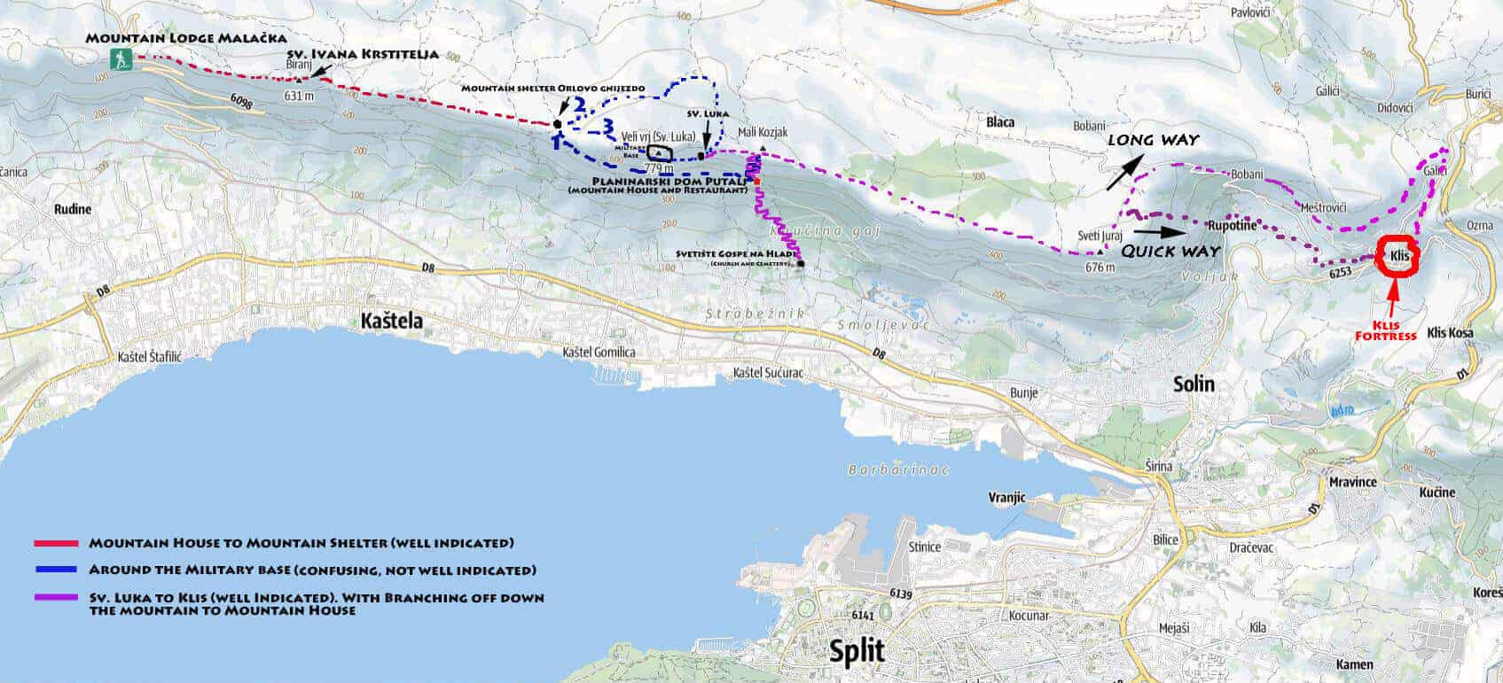
The Route
This post covers the route from Mountain Lodge Malacka (near Split Airport, which is in fact right next to Trogir) all the way to Klis Fortress. That’s approximately 20 km (or 22 km depending on the route you take). Doing the whole thing will take you between 8 to 9 hours at a leisurely pace and allowing for stops. OR you can split the hike at the mid-way point when you come upon the military base (it’s what we unintentionally ended up doing). I go into details below and include a map.
This video gives you an overview. As I say, we split up the hike. But the whole thing can be done in one day if well planned.
Mountain Lodge Malacka to Mountain shelter Orlovo Gnijezdo
In red on the map below.
We started off at the Mountain Lodge Malacka (466 m). Using this as a starting point, you are already on the ridge.
Getting up here: there’s a modern asphalt road that winds itself up the mountain. Goran’s wife Branka drove us from Split, a 30 minute drive. Visitors can take Uber. If you want to save money go to the airport by bus (#37 will get you there from Split) and take Uber or a taxi from there. You’ll see a small lodge, a church, and a large parking lot. You’ve arrived.
We did this hike on a sunny January day. It was a warm day in Split – but arriving at the Mountain House a cold, harsh wind was blowing in from the interior and there was snow on the ground. If doing the hike at this time of year make sure to wear layers.
From the parking lot we had a small ascent. 10 minutes later we were walking along the ridge, clear views in every direction. Facing the Adriatic, the airport was just below to our right. Further away we could see Trogir in the distance. Ahead we could see Split and the mountains going down the coast towards Makarska.

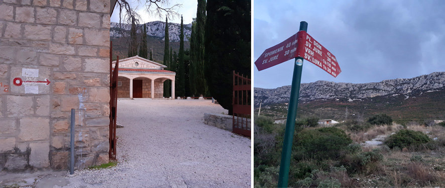
It took us about an hour of mostly flat walking to arrive at a small church. At 631 m, this is Sv. Ivana Krstitelja.


We continued on. It was slow going with the snow, but otherwise it was easy hiking and the winds had died down. Perfect hiking weather with the sun out.

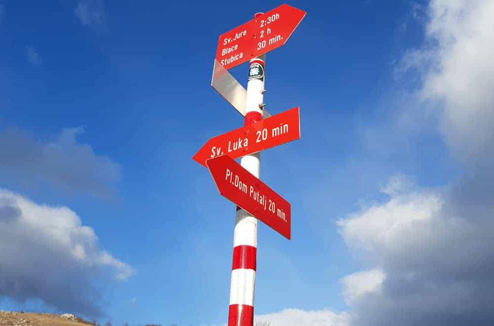
2 hours later we arrived at Mountain shelter Orlovo Gnijezdo (598 m). The shelter is right along the ridge, you are looking right down into the abyss from here, and is protected from the interior winds by part of the cliff. It is the perfect place to stop for lunch. That’s what we did. By then it was 12:30, we had hiked 3 hours from our starting point.


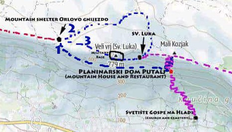
At this point you can a two options, because you are coming up to the blue zone I have on my map.
1. You can follow trails down the mountain. If you keep to your left you will eventually end up at the Planinarski dom Putalj where there is a restaurant with nice views on Split (more on that soon).
2. You can continue on the trail, going up Veli Vrj (the highest peak on Kozjak at 779 m) which is also the home of a military base.
We decided to continue on.

And then we reached this.

There are 3 options to getting around the military base on Veli Vrj
1) The “official” hiking route stipulates that you go back and follow the trails down the mountain. You’ll go to the mountain house at Planinarski dom Putalj, then go back up the mountain on a different trail. That’s a big detour and means climbing down and then coming back up the steepest part of the mountain.
2) We were told by some hikers we met that if you go in the other direction (ie towards the interior) that there is a road that goes around the military base. That’s true (as we would later find out). But at that moment, walking around in the bush in trees and snow we didn’t find any clear trail to head in that direction (note: this is the best way however and what I would recommend).
3) We decided to try and go around the military base by skirting the fence along the cliff. We followed the fence for half an hour. The fence ended and we had no choice but to walk through the military base. Nobody stopped us. In fact the whole base looked deserted. We continued, going up past the huge radar…and then down through the fence on the other side of the base. I don’t recommend cutting through the base to anyone but having read a few Croatian articles on the same subject it seems that hikers have ended up doing exactly what we did.
Below: while on the grounds of the military base, we ran into these. They are Barbary Sheep, native to North Africa but introduced here. They’re large and have scary horns but are timid…they walked away when they saw us coming.


We crossed through the military base and went through the wire fence to get out. Coming down from Veli Vrj, the views are incredible. Right below the base is the small church of Sv. Luka. You’ll have have views of Mosor Mountain and the mountain ranges leading to Mt. Biokovo further up the coast.


We continued on after the small church of Sv. Luka, following the trail along the ridge.


Running out of time….(ie. end of Part 1)
We knew it would be tough making it all the way to Klis. We had passed the small church of Sv Luka at around 2 pm. Signs indicated that it was 2.5 hours more to the peak of Sveti Juraj. We didn’t know (at the time) how far it would be from that point to get to Klis (the answer is 1.5- 2 hrs if taking the fast route through Gornja Rupotina). With the sun setting around 4:30 in January we realized we just didn’t have enough time to complete the hike.
We decided to head back and take the trail down the mountain (see my purple squiggle on the map) to the Planinarski dom Putalj, the mountain house/restaurant.
Total time for the 1st part of the hike was 5 1/2 hours which included stops along the way, getting lost, having to go back to the path down (40 minutes), then heading down the the mountain (45 minutes).
Note: If you end up going down this way, you can continue from Planinarski dom Putalj (the mountain house/restaurant) down the rest of the mountain to Svetiste Gospe na Hladi, a church and cemetery. From there you can call a taxi or uber, or walk a bit further to the main road that goes from Split to Trogir. Next to the Tommy store is the K. Sucurac bus stop. From there you can take the 37 bus into Split.
Svetiste Gospe na Hladi can also be the starting point if continuing the hike (as we did). Part 2 below.
Back on the ridge and on to Klis Fortress (Part 2)
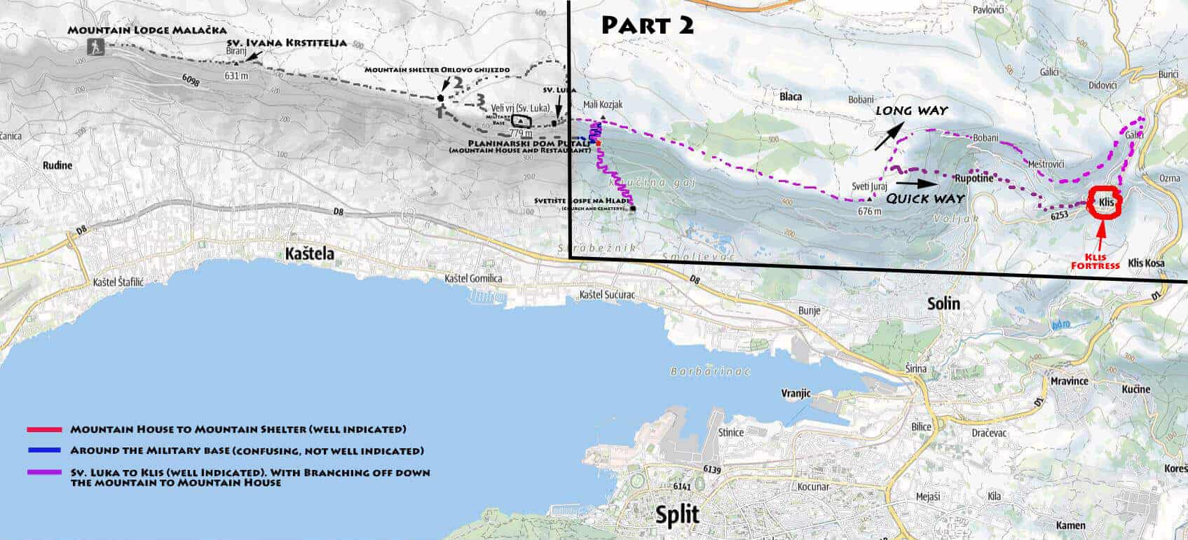
A year later, we came back to complete the hike. We started where we left off, going to Svetiste Gospe na Hladi, hiking up to Planinarski dom Putalj (the mountain house/restaurant), then climbing up the ridge to where we had left off on the previous hike. All that took about an hour.
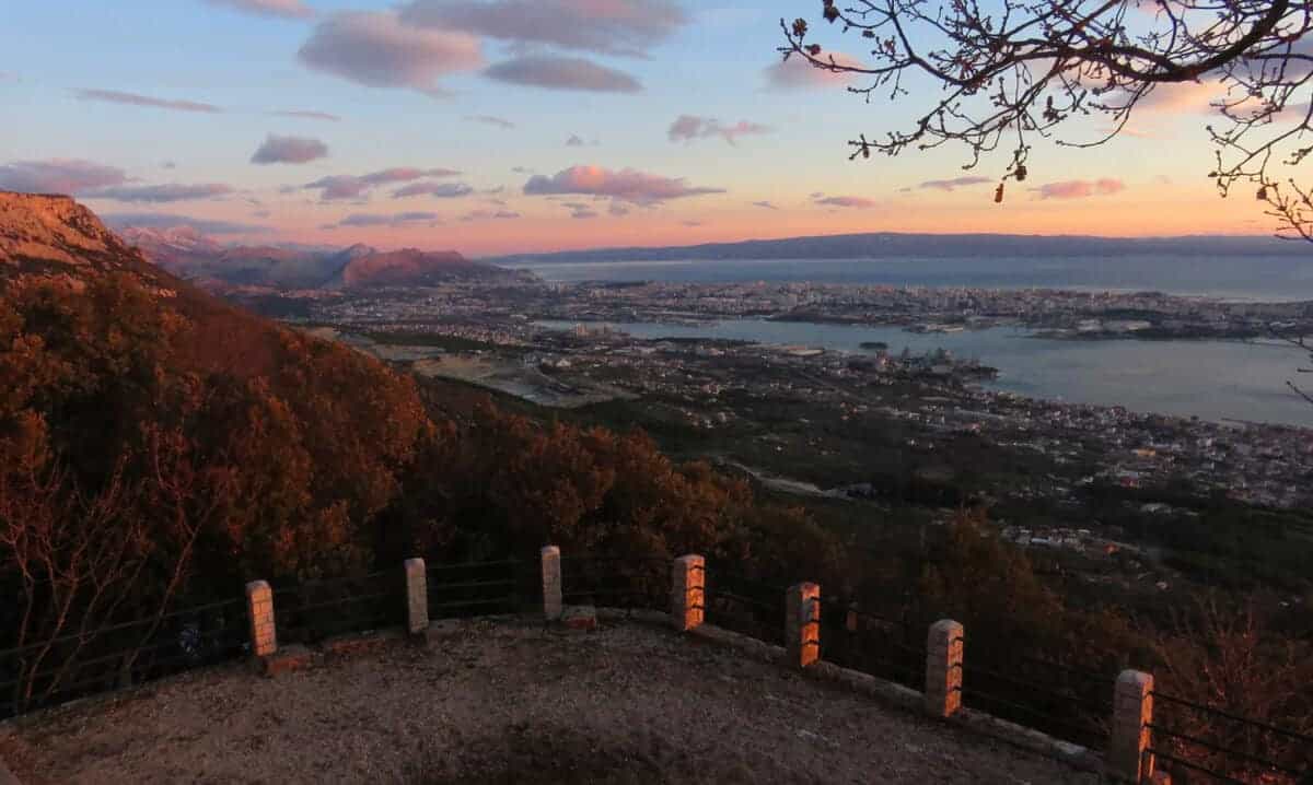
Continuing where we left off, the hike features incredible views of Split and the islands beyond. And if you head next to the edge of the ridge (which you’ll have to do if following the painted signs) you’ll be faced with dizzying views straight down a sheer precipice.


The 2.5 hrs to Sveti Jure culminate with a little ascent. Then you’re at the top. There’s a radar tower, a viewpoint, and a picnic table…then if you walk a few steps further you’ll see the tiny church of Sveti Jure (Saint George). Beyond it are incredible views looking down into the valley towards Klis Fortress and beyond towards Mount Mosor (and the mountain chain that continues all the way down the coast to Mount Biokovo, the 2nd highest mountain in Croatia).
From here it’s downhill. Follow the sign for Gornja Rupotina. You’ll find yourself walking down the ridge, overlooking fantastic views in all directions.


Then you get to only part of the hike we disliked: a steep descent down an embankment of jagged, shale rocks. It’s slippery and you have to watch every step. It took about 20 minutes down before arriving at a dirt path that led us through a small forest.

The path brings you out to a road in front of a house. This is the community of Gornja Rupotina.
Follow the road up past the house and to the right….and then keep following it in the direction of Klis. There are homes along this stretch and you might meet a few dogs. All the ones we met were friendly.

It’ll take you about 30 minutes to arrive at Klis Fortress. The road you’re walking on eventually curves around a cliff…and there is the town of Klis with the fortress towering above it.


Kliss Fortress is worth exploring, it is a famous Game of Thrones location (being the city of Meereen introduced in season 4 of the series).
Part 2 of the hike had taken 5 1/2 hours, including 1 hour to get back up to the ridge and a 45 lunch break at the top of Sveti Jure.
Learning from our mistakes…and how you can do the hike in one day
This hike can easily be done in one day. It’s only because we screwed up that we ended up splitting it up into 2 parts.
We knew we were ambitious trying to do this hike. The full hike is 20 km and with the short winter days we should have planned better.
Mistakes we made:
1. We started at 9:30. It was too late. We should have started around 8 am at the latest.
2. We took too many breaks: admiring views, taking photos, having multiple snack breaks.
3. The Military base screwed us up and we lost a lot of time trying to find our way around it. All the snow also contributed to not being able to follow the path in places
Logically, we should – with our shortcut through the military base – have been able to do the hike comfortably in 8 hours. If we had started at 8 am we would have completed the hike in Klis around 4 pm. So there’s no way we could have completed this hike during daylight hours at this time of year.

Above: image credit to Outdooractive. They have an excellent interactive map if you click on that link. Note however that the official route involves going down the mountain and then back up to get around the Military base (I’ve indicated our shortcut on the altitude graph above). Click to enlarge.
Final thoughts on hiking Kozjak
Most visitors don’t know about Kozjak, they focus on Mosor instead. But Kozjak is a much easier hike with great views throughout. And with easier access points closer to Split you’re not far away. Remember to bring lots of water and sunscreen.
Kozjak is a great (and easy) hike with fantastic views. Very much recommended.

Related: Hiking Mount Mosor the “Man’s Way”
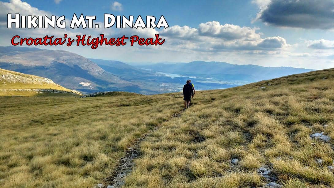
Related: Hiking Mt.Dinara, Croatia’s highest Peak
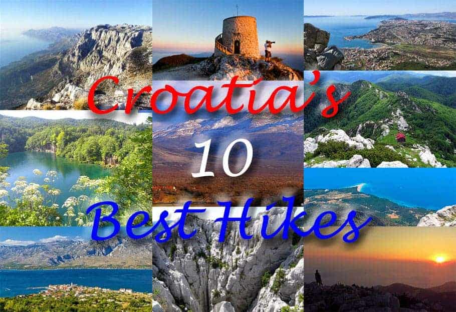
Related: Croatia’s 10 Best Hikes
Leave a Reply